
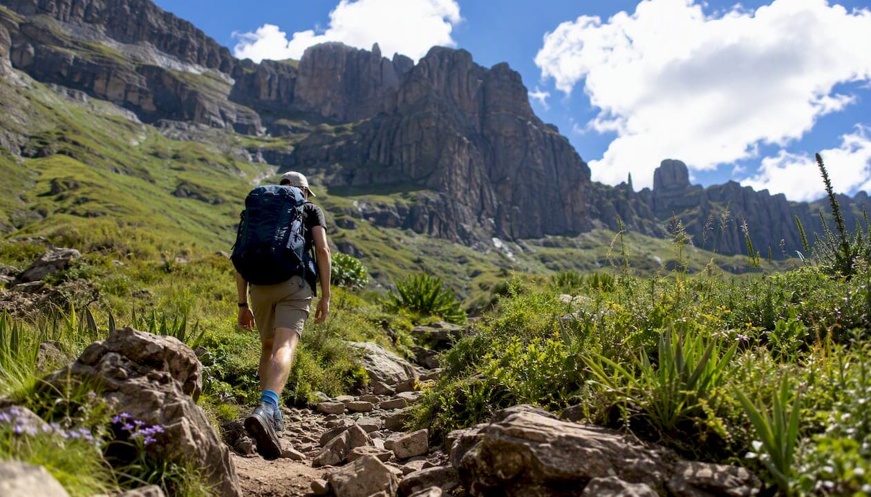
The single best Drakensberg hike for most visitors is the Tugela Falls / Amphitheatre via the Sentinel chain ladders — a 10–14 km round trip that delivers the world's second-highest waterfall, a dramatic escarpment panorama, and a genuine mountain experience without requiring overnight gear. If you have more time, the Giant's Cup Trail is the definitive multi-day classic.
Here is the shortlist to scan before you read further:
- Tugela Falls / Amphitheatre (Sentinel route) — Best for fit day hikers and photographers. Day hike, chain ladders, Free State side. Permit/parking fee required at Sentinel car park.
- Tugela Gorge — Best for families and casual walkers wanting river scenery without ladders. Day hike, Royal Natal National Park. Conservation fee applies.
- Rainbow Gorge — Best for beginners and families. Easy half-day river walk with vivid rock formations. Cathedral Peak Nature Reserve. Conservation fee applies.
- Cathedral Peak — Best for experienced day hikers wanting a summit. Strenuous day hike, Cathedral Peak Nature Reserve. Permit required.
- Giant's Cup Trail — Best for backpackers wanting a structured multi-day route with hut accommodation. ~60 km, 5 days, one-way. Mandatory Ezemvelo KZN Wildlife permit and advance booking essential.
- Mnweni Circuit — Best for experienced wilderness backpackers. ~43–46 km, 3–5 days, remote and rugged. Guide strongly recommended.
- Mafadi — Best for peak-baggers targeting South Africa's highest point (3,450 m). Multi-day, technical approach. Guide required for most parties.
- Mini Traverse (Northern Traverse) — Best for serious trekkers wanting a point-to-point epic. 60–76 km over 4–6 days, guided logistics strongly advised.
Pro Tip: Book Giant's Cup and Mnweni permits through Ezemvelo KZN Wildlife at least 3–6 months ahead during peak season (June–August). Huts fill fast and there is no walk-in option for multi-day wilderness routes.
Key Takeaways
The best Drakensberg hikes reward preparation: pick your trail by fitness and time, secure permits through Ezemvelo KZN Wildlife well ahead of peak season, and hire a local guide for any multi-day or technical route above the escarpment.
| Point | Details |
|---|---|
| Top day hike | Tugela Falls via Sentinel chain ladders (10–14 km, 4–6 hrs) is the best single-day Drakensberg experience for fit hikers. |
| Best multi-day route | Giant's Cup Trail (~60 km, 5 days) offers hut accommodation and managed logistics — the most accessible overnight route. |
| Book permits early | Ezemvelo KZN Wildlife huts and wilderness permits for peak season (June–August) fill 3–6 months in advance. |
| Start early on summit days | Leave the trailhead by 6:00–6:30 AM on escarpment routes; cloud and storms build above 2,500 m by 10:00–11:00 AM. |
| Use Im-at for guided bookings | Im-at lists verified guided Drakensberg hikes with permit and shuttle coordination included, bookable in one place. |
Table of Contents
- What are the best Drakensberg hikes, trail by trail?
- How do you pick the right Drakensberg hike for your fitness and time?
- When is the best time to hike the Drakensberg?
- What permits and bookings do you need for Drakensberg hikes?
- What gear and safety practices matter most in the Drakensberg?
- When should you hire a local guide for Drakensberg hiking?
- Why experienced hikers keep coming back to the Berg
- Book your guided Drakensberg hike through Im-at
- Sources
What are the best Drakensberg hikes, trail by trail?
Community trail data show day hikes in the Drakensberg typically run 4–20 km, while multi-day routes like Giant's Cup and Mnweni cover 43–60 km over several days. Below are the canonical picks, profiled for quick comparison.
Tugela Falls / Amphitheatre (Sentinel chain ladders)
Distance: ~10–14 km return | Duration: 4–6 hours | Difficulty: Moderate–Hard | Routehead: Sentinel car park, Royal Natal (Free State side) | Elevation gain: ~600 m to escarpment (~3,165 m)
The chain ladders are the headline — two vertical steel ladders bolted into the basalt cliff that lift you onto the plateau. They are exposed but well-maintained, and most fit adults manage them without technical climbing skill. From the top, the Amphitheatre wall stretches 5 km and the Tugela drops 948 m in five cascades. Permit/parking fee payable at the gate.
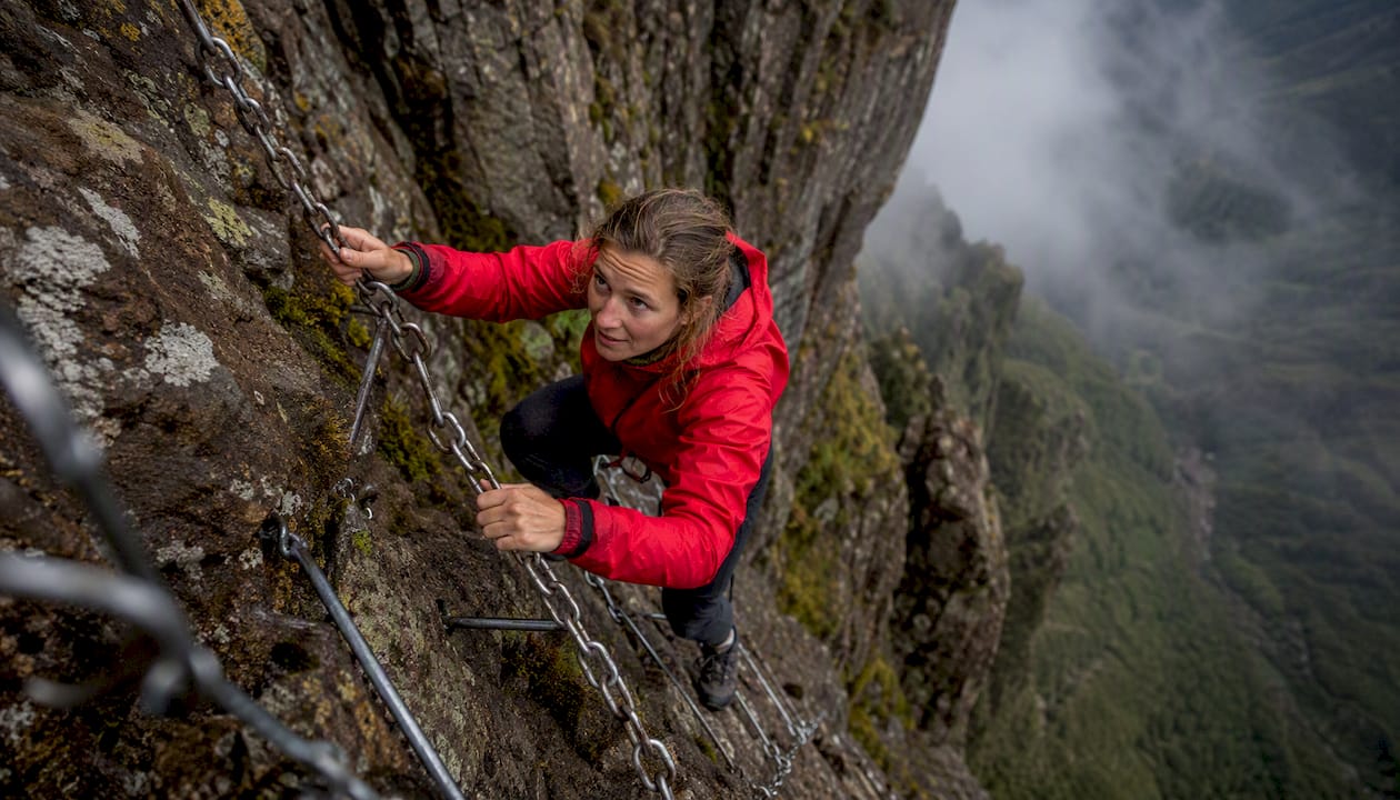
Pro Tip: Start no later than 6:30 AM. Cloud builds on the escarpment by mid-morning, and the ladder sections become genuinely dangerous in wet conditions.
Tugela Gorge
Distance: ~14 km return | Duration: 5–6 hours | Difficulty: Easy–Moderate | Routehead: Mahai campsite, Royal Natal National Park | Elevation gain: ~400 m
This is the river-canyon approach, not the escarpment ascent. The trail follows the Tugela River through a narrow gorge, ending at a pool beneath the lower falls. You do not reach the top of Tugela Falls from here — but the canyon walls, ferns, and swimming holes make it one of the most rewarding valley walks in the Berg. Royal Natal conservation fee applies.
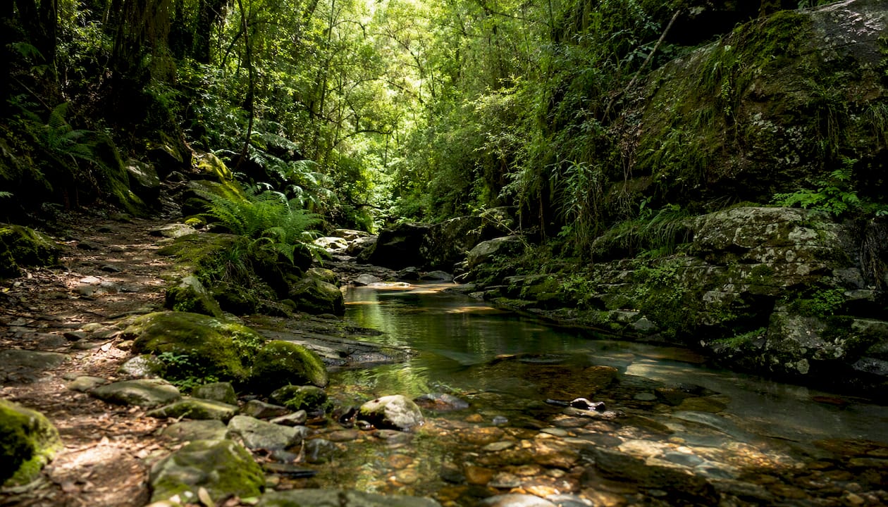
Pro Tip: After heavy rain, the gorge trail floods and river crossings become impassable. Check conditions at the park office before setting out.
Rainbow Gorge
Distance: ~8 km return | Duration: 3–4 hours | Difficulty: Easy | Routehead: Cathedral Peak Hotel / Cathedral Peak Nature Reserve | Elevation gain: ~200 m
Rainbow Gorge earns its name from the way light catches the orange and red sandstone walls above the stream. It is the most accessible of the top hiking trails in the Drakensberg — flat enough for older children and anyone new to mountain walking. The path follows the Ndumeni River through indigenous forest and open grassland. Conservation fee applies at the reserve gate.
Pro Tip: Go in the morning when the sun hits the gorge walls directly. By afternoon the canyon is in shadow and the color effect disappears.
Cathedral Peak
Distance: ~18 km return | Duration: 7–9 hours | Difficulty: Hard | Routehead: Cathedral Peak Nature Reserve | Elevation gain: ~1,100 m to summit (~3,004 m)
Cathedral Peak is a genuine summit hike, finishing on a narrow rocky pinnacle with 360-degree views across the Little Berg and escarpment. The upper section involves scrambling on exposed rock. A permit is required and the park office can advise on current route conditions. Not suitable as a first Drakensberg hike.
Pro Tip: The final scramble to the true summit is optional — the saddle below already gives extraordinary views and is a safer turnaround for hikers without scrambling experience.
Giant's Cup Trail
Distance: ~60 km one-way | Duration: 5 days | Difficulty: Moderate | Routehead: Sani Pass (start) to Bushman's Nek (end) | Elevation gain: Cumulative ~3,000 m | Permit: Mandatory via Ezemvelo KZN Wildlife
The Giant's Cup is South Africa's most popular multi-day wilderness trail, and for good reason. Five days of walking through montane grassland, past San rock art sites and river crossings, with hut accommodation each night. Because it is one-way, you need shuttle logistics at both ends. Ezemvelo KZN Wildlife manages permits and hut bookings; failing to carry a valid permit can result in denied access or fines. Book 3–6 months ahead for peak season.
Pro Tip: Arrange your shuttle before you book the permit. Sani Pass and Bushman's Nek are not close to each other, and last-minute transport is unreliable.
Mnweni Circuit
Distance: ~43–46 km | Duration: 3–5 days | Difficulty: Hard | Routehead: Mnweni Cultural Centre, Northern Drakensberg | Elevation gain: ~2,000 m+ | Permit: Required via Ezemvelo
Remote, poorly signed, and genuinely wild. The Mnweni Circuit crosses high passes, traverses the escarpment edge, and passes through landscapes that see far fewer hikers than the southern Berg. Navigation is demanding and a local guide is strongly recommended for first-timers. The cultural centre at the trailhead is the only reliable permit and information point.
Pro Tip: Carry a 1:50,000 topographic map (Chief Directorate: National Geo-spatial Information) and a GPS device. Cairns are sparse and mist can descend in minutes.
Mafadi
Distance: ~30–40 km round trip (varies by approach) | Duration: 3–4 days | Difficulty: Hard–Extreme | Routehead: Injisuthi Camp, Giant's Castle Game Reserve | Altitude: 3,450 m (South Africa's highest peak) | Permit: Required
Mafadi sits on the Lesotho border and reaching it involves a sustained high-altitude approach with significant scrambling. Most parties hire a guide for the final ascent. The Injisuthi approach is the most common, passing through one of the Drakensberg's richest San rock art areas. Altitude symptoms are possible above 3,000 m — ascend gradually and stay well hydrated.
Pro Tip: Allow an acclimatization night at Injisuthi Camp (1,524 m) before pushing for the escarpment. The altitude jump is significant and rushing it leads to headaches and poor decision-making on exposed terrain.
Mini Traverse (Northern Traverse)
Distance: 60–76 km | Duration: 4–6 days | Difficulty: Hard | Routehead: Varies by operator; typically Sentinel to Mnweni or Rockeries Pass | Permit: Required; guided logistics strongly advised
The Mini Traverse links the Northern Berg's major passes and escarpment sections in a point-to-point route that most hikers consider the best multi-day experience in the range. Logistics are complex — multiple permit zones, remote resupply, and shuttle coordination. Most people who complete it do so with a guided operator who handles the paperwork and carries group gear.
| Trail | Best for | Distance | Duration | Elevation gain / altitude | Difficulty | Routehead / park | Permit required | Key highlight |
|---|---|---|---|---|---|---|---|---|
| Tugela Falls (Sentinel) | Fit day hikers, photographers | 10–14 km return | 4–6 hrs | ~600 m / ~3,165 m | Moderate–Hard | Sentinel car park, Royal Natal (Free State) | Yes (parking/gate fee) | Chain ladders, Amphitheatre wall, Tugela Falls |
| Tugela Gorge | Families, casual walkers | ~14 km return | 5–6 hrs | ~400 m | Easy–Moderate | Mahai camp, Royal Natal NP | Yes (conservation fee) | River canyon, pools, lower falls |
| Rainbow Gorge | Beginners, families | ~8 km return | 3–4 hrs | ~200 m | Easy | Cathedral Peak Nature Reserve | Yes (conservation fee) | Colored sandstone walls, stream |
| Cathedral Peak | Experienced day hikers | ~18 km return | 7–9 hrs | ~1,100 m / ~3,004 m | Hard | Cathedral Peak Nature Reserve | Yes | Summit panorama, scrambling |
| Giant's Cup Trail | Backpackers, first multi-day | ~60 km one-way | 5 days | ~3,000 m cumulative | Moderate | Sani Pass to Bushman's Nek | Yes — Ezemvelo booking | Hut-to-hut, rock art, montane grassland |
| Mnweni Circuit | Experienced wilderness hikers | ~43–46 km | 3–5 days | ~2,000 m+ | Hard | Mnweni Cultural Centre | Yes — Ezemvelo | Remote escarpment, passes, solitude |
| Mafadi | Peak-baggers, mountaineers | ~30–40 km | 3–4 days | To 3,450 m | Hard–Extreme | Injisuthi Camp, Giant's Castle | Yes | South Africa's highest summit |
| Mini Traverse | Serious trekkers | 60–76 km | 4–6 days | Multiple high passes | Hard | Sentinel / Rockeries Pass | Yes — multiple zones | Full Northern Berg traverse |
How do you pick the right Drakensberg hike for your fitness and time?
The honest answer is that most people overestimate their fitness and underestimate the altitude. A quick decision checklist before you commit:
- Time available: One day points you toward Tugela Falls (Sentinel), Tugela Gorge, Rainbow Gorge, or Cathedral Peak. Two or more days opens Giant's Cup, Mnweni, Mafadi, and the Mini Traverse.
- Fitness level: Can you sustain 6+ hours of uphill walking with a loaded pack? If not, stick to the valley day hikes. Cathedral Peak and Mafadi demand real cardiovascular fitness.
- Altitude experience: The escarpment sits above 3,000 m. If you have never hiked above 2,500 m, plan an acclimatization day and watch for headache, nausea, or unusual fatigue.
- Technical comfort: Chain ladders (Sentinel route) and the Cathedral Peak summit scramble require comfort with exposure. If heights are an issue, Tugela Gorge and Rainbow Gorge are equally beautiful and technically straightforward.
- Weather tolerance: Multi-day routes expose you to afternoon storms, possible snow in winter, and rapid temperature drops. A day hiker caught in a storm can retreat; a backpacker on the Mnweni escarpment cannot.
The rough rule of thumb that works for most visitors: casual hikers belong on Rainbow Gorge or the Tugela Gorge river walk; fit day hikers ready for ladders and exposure should target the Sentinel/Tugela Falls route; experienced backpackers with navigation skills and multi-day kit should look at Giant's Cup first, then Mnweni or the Mini Traverse once they know the terrain.
The tradeoff between day hikes and multi-day routes is real. Day hikes give you the scenery and the physical challenge without the logistics burden — no shuttle coordination, no hut booking windows, no carrying five days of food. Multi-day routes give you the Berg at dawn and dusk, the silence of the high escarpment, and the kind of perspective that a day trip simply cannot replicate. Neither is objectively better. They answer different questions.
Chain-ladder bottlenecks, river crossings, photo stops, and afternoon weather all eat into your schedule faster than the numbers suggest.*
When is the best time to hike the Drakensberg?
April through September is the recommended window for clear skies and fewer afternoon thunderstorms. That said, each season has a distinct character worth understanding before you book flights.
Autumn (March–May) brings exceptional visibility, warm days, and the first flush of golden grassland color. Stream levels are still high from summer rain, so some river crossings remain tricky in early autumn. By May, conditions are close to ideal.
Winter (June–August) is peak hiking season. Days are clear, cold, and dry. Snow is possible above 2,500 m, especially on the escarpment, and can make chain-ladder sections icy and dangerous. Carry crampons or microspikes if you are heading to the Sentinel in July or August. Daylight is shorter, which compresses your summit window.
Spring (September–October) delivers wildflowers across the Little Berg grasslands and warming temperatures. Stream levels are low, making river crossings straightforward. This is arguably the most photogenic season for valley hikes like Rainbow Gorge and Tugela Gorge.
Summer (November–February) is the most popular tourist season but the hardest for summit hiking. Near-daily afternoon thunderstorms build above ~2,500 m, often by 11:00 AM on the plateau. Lightning on exposed ridgelines is a genuine fatality risk. If you hike in summer, start before 6:30 AM on any summit or escarpment route, and plan to be off exposed terrain by midday.
Safety callout: On plateau and escarpment routes above 2,500 m, cloud typically builds by 10:00–11:00 AM in summer. A 6:00–6:30 AM start gives you a 4–5 hour window before conditions deteriorate. That is enough for Tugela Falls (Sentinel) but tight for Cathedral Peak — plan accordingly.
High stream flows after heavy summer rain can make the Tugela Gorge trail impassable and add significant risk to multi-day river crossings on Giant's Cup and Mnweni. Always check with the park office within 48 hours of departure.
What permits and bookings do you need for Drakensberg hikes?
Many overnight and wilderness routes require advance permits and bookings through Ezemvelo KZN Wildlife. Arriving without a permit on a managed route can mean denied access or a fine — and on a multi-day route, that means a wasted trip.
Step-by-step for securing access:
- Identify your route and park. Each section of the Drakensberg falls under a different reserve or park (Royal Natal, Cathedral Peak Nature Reserve, Giant's Castle, Injisuthi, Mnweni Cultural Centre). Confirm which authority manages your specific trail.
- Check current fees and availability. Visit the Ezemvelo KZN Wildlife website or call the relevant park office directly. Fees change seasonally and are quoted in South African rand.
- Book huts or campsites for multi-day routes. Giant's Cup huts are bookable through Ezemvelo online. Demand is high during winter (June–August) — book 3–6 months ahead. Mnweni and Mafadi approaches require permit registration at the trailhead office or cultural centre.
- Pay the conservation/gate fee on arrival for day hikes at Royal Natal and Cathedral Peak Nature Reserve. These are not pre-bookable but must be paid before you enter.
- Confirm shuttle logistics for one-way routes (Giant's Cup, Mini Traverse) before finalizing your booking. The Sani Pass end and Bushman's Nek end of Giant's Cup are not served by public transport.
- Sani Pass / Lesotho border note. Approaches to Thabana Ntlenyana and some Mafadi routes cross into Lesotho. Carry a valid passport and confirm current border-crossing requirements with the relevant authorities before departure.
Pro Tip: Print your permit confirmation and carry a physical copy. Cell signal is unreliable at most trailheads and park rangers cannot verify digital bookings when there is no connectivity.
What gear and safety practices matter most in the Drakensberg?
The Berg punishes under-preparation faster than most South African hiking destinations. Altitude, rapid weather changes, and poor signage on remote routes are the three factors that generate the most rescues.
| Item | Day hike | Overnight / multi-day |
|---|---|---|
| Water (minimum) | 2–3 liters + purification tablets | 3+ liters + filter or purification |
| Clothing layers | Moisture-wicking base, fleece, waterproof shell | Full layering system, down jacket, thermal base |
| Shelter | Emergency bivy (lightweight) | Tent or confirmed hut booking |
| Sleep system | Not required | Sleeping bag suitable for winter conditions |
| Stove and food | Snacks and lunch only | Full cook kit, 5+ days food for remote routes |
| Navigation | Downloaded offline map (Maps.me or Gaia GPS) + compass | 1:50,000 topo map + GPS device + compass |
| Headlamp | Yes, with spare batteries | Yes, with spare batteries |
| First aid | Basic kit | Extended kit including blister care, altitude medication |
| Emergency comms | Charged phone (limited signal) | PLB or satellite communicator (InReach or SPOT) |
Navigation reality: Signage on the Drakensberg is inconsistent. The Sentinel and Giant's Cup routes are reasonably well-marked, but Mnweni, Mafadi approaches, and the Mini Traverse rely heavily on cairns, faint paths, and your own map-reading. Do not rely solely on a phone app — batteries drain fast in cold conditions and screens are unreadable in bright sun.
Altitude: The escarpment plateau sits between 2,800 m and 3,450 m. Acute mountain sickness is uncommon at these elevations for healthy adults but not impossible, particularly if you ascend quickly from sea level. Headache, nausea, and unusual fatigue are the warning signs. Descend if symptoms worsen.
River crossings: After significant rain, crossings on Giant's Cup and Mnweni can be waist-deep and fast-moving. The rule is simple: if you cannot see the bottom and the current is strong, wait or turn back. Drowning in river crossings is a documented cause of Drakensberg fatalities.
Leave No Trace: Camp only in designated sites or booked huts. Pack out all waste including food scraps and toilet paper. San rock art panels are irreplaceable — do not touch, trace, or photograph with flash. Stay on marked paths near art sites to avoid trampling the surrounding archaeological context.
Pro Tip: Register your hiking plan with the park office or your accommodation before departure, even on day hikes. If you are not back by your stated return time, rangers know where to start looking.
When should you hire a local guide for Drakensberg hiking?
The short answer: for any multi-day route above the escarpment, or any technical route you have not done before, a local guide is worth every rand. Experienced mountain guides consistently emphasize that the Drakensberg is a large, rugged wilderness where independent navigation can become perilous quickly due to poor signage and rapidly changing weather.
When a guide is optional: Rainbow Gorge, Tugela Gorge, and the Sentinel/Tugela Falls route are well-trafficked and reasonably signed. Confident, experienced hikers with good navigation skills and the right gear can manage these independently.
When a guide is strongly recommended: Mnweni Circuit, Mafadi, the Mini Traverse, and any route crossing into Lesotho. These routes involve complex navigation, remote terrain, and logistics that benefit significantly from local knowledge.
When a guide is practically required: Technical approaches in poor weather (icy chain ladders, exposed scrambles in mist), any group with inexperienced members on multi-day routes, and routes where the permit system is linked to a registered guide operator.
What to ask before you book a guide:
- Are they registered with a recognized South African guiding body or the relevant park authority?
- What is their group size limit, and what is the guide-to-client ratio?
- Does their fee include permits, meals, and porters, or are those separate?
- What emergency and rescue arrangements do they carry (first aid certification, PLB, satellite comms)?
- What is the cancellation and deposit policy?
Pro Tip: Book your guide at least 2–3 months ahead for winter season (June–August). The best operators fill their Mafadi and Mini Traverse slots by April.
The Mini Traverse is a good example of where guided logistics really pay off: multiple permit zones, remote resupply, and shuttle coordination across 60–76 km of terrain are genuinely complex to self-organize on a first attempt.
Why experienced hikers keep coming back to the Berg
The Drakensberg does not reveal itself on a single trip. The first visit is usually about the obvious landmarks — the chain ladders, the Amphitheatre wall, the falls. The second trip is when you start to notice what the Berg actually is: a 200-million-year-old basalt cap sitting on ancient sandstone, carved by rivers into a landscape that shifts from subtropical forest to alpine tundra within a few vertical kilometers.
What keeps experienced hikers returning is the combination of geological drama and biological richness that is hard to find anywhere else in southern Africa. Bearded vultures (lammergeiers) ride thermals above the escarpment. Eland move through the high grasslands at dawn. The San rock art panels at Injisuthi and along the Giant's Cup route are not museum pieces — they are painted into living rock in landscapes that look much as they did when the paintings were made.
The practical tip that most first-timers miss: slow down on the Little Berg. The plateau gets the attention, but the mid-altitude zone between 1,500 m and 2,200 m, where the sandstone caves, protea woodland, and river gorges sit, is where the Berg's character lives. A half-day spent in Rainbow Gorge or the lower Tugela valley teaches you more about the place than a fast summit push.
Book your guided Drakensberg hike through Im-at
Planning a Drakensberg trip means juggling permits, shuttles, guide qualifications, and accommodation — all before you even lace up your boots. Im-at cuts through that by putting verified, bookable guided hikes in one place, so you spend your time hiking, not emailing operators.
Through Im-at's marketplace, you can browse guided hiking experiences with clear listings showing what is included, check guide credentials and reviews before committing, and handle permit and transfer coordination as part of a single booking. For travelers who want the full Berg experience without the logistics headache, a private Drakensberg tour through Im-at covers transport, guiding, and accommodation in one package. If you are building a longer South Africa itinerary, the 7-day South Africa and Eswatini adventure tour shows how the Berg fits into a broader regional trip.
Browse available Drakensberg guided hikes on Im-at and book your route before peak-season slots close.
Pro Tip: When comparing guide listings on Im-at, filter by reviews and check whether rescue coverage and permits are included in the listed price. A lower headline price that excludes permits and shuttles often costs more in the end.
Sources
These are the authoritative references for current permit rules, trail distances, and booking procedures.
- Drakensberg Hiking Guide | The South African Guide
- Exploring the Drakensberg: A Quick Guide to 7 Top Trails
- The best walks and hikes in the Drakensberg | Komoot
- The Best Drakensberg Hikes That'll Take Your Breath Away
For current trail conditions on technical routes (Mnweni, Mafadi, Mini Traverse), contact a registered local guide operator directly. Conditions change after heavy rain and in winter, and no online source updates fast enough to substitute for a phone call to someone who was on the trail last week.